Layers in Tilezen's vector tiles
The Tilezen vector tiles provides worldwide basemap coverage sourced from OpenStreetMap and other open data projects, updated intermittently as a free & shared service at Nextzen.org.
Data is organized into several thematic layers, each of which is named, for example; buildings, pois, and water. A selection of these layers are typically used for base map rendering, and are provided under the short-hand name all. Each layer includes a simplified view of OpenStreetMap data for easier consumption, with common tags often condensed into a single kind field as noted below.
Need help displaying vector tiles in a map? Here are several examples using Tilezen vector tiles to style in your favorite graphics library including Tangram, Mapbox GL, D3, and OpenLayers.
Overview
Data sources and attribution
Tilezen primarily sources from OpenStreetMap, but includes a variety of other open data. For a full listing, view the data sources. Each source may require attribution in your project.
Feature names
Most Tilezen vector tile features include a basic name property (common):
name- Generally the name the locals call the feature, in the local script.
It supports several additional name related properties (optional):
alt_nameint_nameloc_namename:short- For example:CAfor California. See planned bug fix #1102 and see planned bug fix #1094 for abbreviated names.name_leftname_rightnat_nameofficial_nameold_namereg_nameshort_name
Name localization
Tilezen includes all language variants of the name:* values to enable full internationalization (when different from name).
Language variants are identified by an ISO 639-1 two-letter language code and optional country code, for example en for English and less commonly en_GB for British English. Mapzen house styles designed in Tangram support displaying all language scripts.
We additionally localize alt_name:* and old_name:* properties for features across all layers.
For features in the boundaries layer, there are two additional variants name:left and name:right to support oriented labeling on the appropriate side of the boundary line (so the labeled polygon's text can appear inside that polygon consistently). See planned bug fix #1102.
Localized name properties (common-optional):
name:*alt_name:*old_name:*name:left:*See planned bug fix #1102.name:right:*See planned bug fix #1102.
Geometry types
Individual Tilezen vector tile layers can include mixed geometry types. This is common in the landuse, water, and buildings layers.
A tile geometry can be one of three types:
- Point, MultiPoint
- LineString, MultiLineString
- Polygon, MultiPolygon
In Tangram, Mapzen's GL graphics library, the keyword $geometry matches the feature's geometry type, for cases when a FeatureCollection includes more than one type of kind of geometry. Valid geometry types are:
point: matches Point, MultiPointline: matches LineString, MultiLineStringpolygon: matches Polygon, MultiPolygon
Tangram scene file examples:
filter: { $geometry: polygon }            # matches polygons only
filter: { $geometry: [point, line] }      # matches points & lines
filter: function() { return $geometry === 'line' }  # matches lines
Mapnik supports geometry filtering via the special mapnik::geometry_type keyword.
CartoCSS Examples:
#layer['mapnik::geometry_type'=1] { /* point styles */ }
#layer['mapnik::geometry_type'=2] { /* line styles */ }
#layer['mapnik::geometry_type'=3] { /* polygon styles */ }
Data updates
Most Tilezen vector tile content is updated minutely from OpenStreetMap. Low and mid-zoom tiles are updated approximately monthly. Some source data rarely updates – Natural Earth updates approximately yearly.
Changelog
The current version of Tilezen vector tile data schema is v1.6.0.
Tiles are still in active development, but Tilezen promises to minimize backwards incompatible breaking changes. Data model promises are listed in the Tilezen SEMANTIC VERSIONING statement.
You can send your feedback at hello@nextzen.org or via our Gitter chat room.
Read the full details in the project CHANGELOG.
Feature ordering
Ordering of features - which ones draw "on top of" other features - can be an important feature of display maps. To help out with this, there is a sort_rank property on some features which suggests in what order the features should appear. Lower numbers mean that features should appear "towards the back" and higher numbers mean "towards the front". These numbers are consistent across layers. The layers which include sort_rank on their features are: boundaries, buildings, earth, landuse, roads, transit and water.
To facilitate data visualization overlays and underlays, the following client-side order ranges are suggested:
0-9: Under everything. Tip: disable earth layer.190-199: Under water. Above earth and most landuse.290-299: Under roads. Above borders, water, landuse, and earth. Your classic "underlay".490-499: Over all line and polygon features. Under map labels (icons and text), under UI elements (like routeline and search result pins). Your classic raster map overlay.
Tangram scene file example:
draw:
    polygons:
        order: 490
Layer reference
Tilezen vector tiles include 9 default layers (and 2 optional layers):
boundaries,buildings,earth,landuse,places,pois,roads,transit, andwater
These individual layers are grouped into an all layer – use this special layer for all your general purpose mapping needs.
While the service can return just a single layer or combination of layers, the all layer is more performant.
The Tilezen vector tiles schema defines 2 optional layers:
traffic_flowandtraffic_incidents
Boundaries
- Layer name:
boundaries - Geometry types:
line
Combination of OpenStreetMap administrative boundaries (zoom >= 8) and Natural Earth boundaries (zoom < 8).
Boundaries properties (common):
name: A suggested label, formed from the left and right region names, if available. If the name appears to be too long to be rendered on the geometry at a particular zoom it may be omitted.id: Identifier for the feature, only provided at zoom 13+.kind: mapping of OpenStreetMap'sadmin_levelint values to strings likecountryandstate, plusaboriginal_landsboundary type, and also includes normalized Natural Earth values. To handle disagreements about the location of borders, thekindmay be prefixed withunrecognized_, e.g:unrecognized_country, for some differing viewpoints (seekind:xxbelow).kind_detail: mapping of OpenStreetMap'sadmin_levelvalues.2for countries,4for regions, and6,8(zoom 10+)source:openstreetmap.orgornaturalearthdata.comsort_rank: a suggestion for which order to draw features. The value is an integer where smaller numbers suggest that features should be "behind" features with larger numbers.min_zoom: a suggested minimum zoom at which the boundary line should become visible based on scalerank value from Natural Earth, and invented for OpenStreetMap, a float.
Boundaries properties (common optional):
kind:xx: alternatekindaccording to the viewpointXX. If you want to show features according to a particular viewpoint, then usekind:xxif it exists and fall back tokindif not. The range of values is the same as forkind. Note that the viewpoints are either lower-case ISO 3166-1 alpha-2 codes or the pseudo-codeiso.id:left: For the relation on the left side of the boundary line. This is only provided at zoom 13+.id:right: For the relation on the right side of the boundary line. This is only provided at zoom 13+.name:left: See name section above, other variants likeold_namealso supported. See planned bug fix in #1102.name:right: See name section above, other variants likeold_namealso supported. See planned bug fix in #1102.maritime_boundary: a special Tilezen calculated value loosely coupled with OpenStreetMap's maritime tag, but with spatial buffer processing for lines falling in the ocean.
Boundaries properties (optional):
osm_relation:true, which can also be deduced from negativeidvalues.
Boundary kind values:
aboriginal_landscountrycountydisputedindefiniteindeterminatelease_limitline_of_controllocalitymacroregionmap_unitoverlay_limitregion
Buildings and Addresses
- Layer name:
buildings - Geometry types:
pointandpolygon
Polygons from OpenStreetMap representing building footprints, building label placement points, building_part features, address points, and entrance and exit points. Starts at zoom 13 by including huge buildings, progressively adding all buildings at zoom 16+. Address points are available at zoom 16+, but marked with min_zoom: 17 to suggest that they are suitable for display at zoom level 17 and higher.
Individual building_part geometries from OpenStreetMap following the Simple 3D Buildings tags at higher zoom levels. Building parts may receive a root_id corresponding to the building feature, if any, with which they intersect.
Tilezen calculates the landuse_kind value by intercutting buildings with the landuse layer to determine if a building is over a parks, hospitals, universities or other landuse features. Use this property to modify the visual appearance of buildings over these features. For instance, light grey buildings look great in general, but aren't legible over most landuse colors unless they are darkened (or colorized to match landuse styling).
Label position points may also have closed or historical kind_detail values if the original building name ended in "(closed)" or "(historical)", respectively. These points will have a min_zoom of 17, suggesting that they are suitable for display only at high zooms. See related bug fix in #1026.
Values for kind_detail are sourced from OpenStreetMap's building tag for building footprints and from building:part tag for building parts.
Note that building geometries, like most geometries in Tilezen tiles, are clipped to the bounds of the tile, even if the building extends beyond the tile. This means that it might be necessary to assemble geometry from several neighbouring tiles to recreate the full building. Some buildings are exceptionally large and span many tiles, so this can be tricky.
Building properties (common):
nameid: from OpenStreetMapkind: see belowkind_detail: see belowsource:openstreetmap.orglanduse_kind: See description above, values match values in thelanduselayer.sort_rank: a suggestion for which order to draw features. The value is an integer where smaller numbers suggest that features should be "behind" features with larger numbers.min_zoom: a suggested minimum zoom at which the building should become visible based on area and volume limits.
Building properties (common optional):
addr_housenumber: value from OpenStreetMap'saddr:housenumbertagaddr_street: value from OpenStreetMap'saddr:streettagarea: in square meters (spherical Mercator, no real-world),polygonfeatures only.building_material: A description of the material covering the outside of the building or building part, if the information is available. Common values are:brick,cement_block,clay,concrete,glass,masonry,metal,mud,other,permanent,plaster,sandstone,semi-permanent,steel,stone,timber-framing,tin,traditionalandwood, and there are many other less common values.height: in meters, where availablelayerlocation: from OpenStreetMap to indicate if building is underground, similar tolayer.min_height: value frommin_heightin meters, where available, otherwise estimated frombuilding:min_levelsif presentroof_color: fromroof:colortagroof_height: fromroof:heighttagroof_material: fromroof:materialtagroof_orientation: fromroof:orientationtagroof_shape: fromroof:shapetagscale_rank: calculation of a feature's importancevolume: calculated on feature'sareaandheight, whenheightormin_heightis available.
Building layer kind values:
buildingbuilding_partaddressentranceexit
Building footprint and label placement kind_detail values:
abandonedadministrativeagriculturalairportallotment_houseapartmentsarbourbankbarnbasilicabeach_hutbell_towerboathousebrewerybridgebungalowbunkercabincarportcastlecathedralchapelchimneychurchcivicclinicclosed. See planned bug fix in #1026.clubhousecollapsedcollegecommercialconstructioncontainerconventcowsheddamdamageddepotdestroyeddetacheddisuseddormitoryduplexfactoryfarmfarm_auxiliaryfire_stationgaragegaragesgazebogerglasshousegovernmentgrandstandgreenhousehangarhealthcarehermitagehistorical. See planned bug fix in #1026.hospitalhotelhousehouseboathutindustrialkindergartenkiosklibrarymallmanormanufacturemixed_usemobile_homemonasterymortuarymosquemuseumofficeoutbuildingparkingpavilionpowerprisonproposedpubpublicresidentialrestaurantretailroofruinruinsschoolsemidetached_houseserviceshedsheltershopshrinesiloslurry_tankstablestadiumstatic_caravanstoragestorage_tankstoresubstationsummer_cottagesummer_housesupermarketsynagoguetanktempleterracetowertrain_stationtransformer_towertransportationuniversityutilityverandawarehousewayside_shrineworks
Additional kind_detail values are provided from POI kinds where one is not available from the building feature. This means that you could see any POI kind value as a building kind_detail value.
Building part kind_detail values:
archbalconybasecolumndoorelevatorentrancefloorhallmainpassagewaypillarporchramproofroomstepsstilobatetiertowerverticalpassagewallwindow
Entrance and exit kind_detail values
Entrances can have an optional kind_detail. If present, it will be one of:
garagehomemainprivateresidencesecondaryservicestaircaseunisex- seems to be mostly mapped on building containing toilets.
Exits can have an optional kind_detail. If present, it will be one of:
emergencyfire_exit
Earth

- Layer name:
earth - Geometry types:
polygon,line,point.
Polygons representing earth landmass and natural feature lines. Uses coastline-derived land polygons from osmdata.openstreetmap.de. Natural lines from OpenStreetMap representing cliffs, aretes. This layer also includes earth label_placement lines for ridges and valleys (which should not otherwise be symbolized).
Uses Natural Earth until zoom 7, then switches to OSM land at zoom 8+.
Earth properties:
name: generally only for lines or label placement pointsid: Theosm_idor funky value when from Natural Earth or OSMData.OpenStreetMap.dekind: eitherearthor "natural" value from OSM tag.source:openstreetmap.orgornaturalearthdata.comsort_rank: a suggestion for which order to draw features. The value is an integer where smaller numbers suggest that features should be "behind" features with larger numbers.min_zoom: a suggestion for which zoom to draw a feature. The value is a float. See planned bug fix in #1073.
Earth kind values:
archipelago- point, intended for label placement onlyarete- linecliff- line, intended for label placement onlycontinent- point, intended for label placement onlyearth- polygonisland- point, intended for label placement onlyislet- point, intended for label placement onlyridge- line, intended for label placement onlyvalley- line, intended for label placement only
Landuse
- Layer name:
landuse - Geometry types:
pointandpolygon
Landuse polygons from OpenStreetMap representing parks, forests, residential, commercial, industrial, university, sports and other areas. Includes OpenStreetMap data at higher zoom levels, and Natural Earth polygons at lower zoom levels. This layer also includes landuse label_placement points for labeling polygons de-duplicated across tile boundaries.
Zooms 4 and 5, 6 and 7 includes a mix of Natural Earth urban_area (zooms 0-9 only) features and OpenStreetMap data for national_park, protected_area, and nature_reserve only. After that more more feature kinds are included, and they have a richer set of properties including sport, religion, surface, attraction, zoo, and natural. Feature selection is filtered per zoom until zoom 15.
At mid- and low-zooms, between 4-12, some landuse polygons are merged to reduce payload size. To facilitate this, the name of the landuse area may be dropped for small polygons. When polygons are merged, the original id properties are dropped, and the area is re-calculated for the new size.
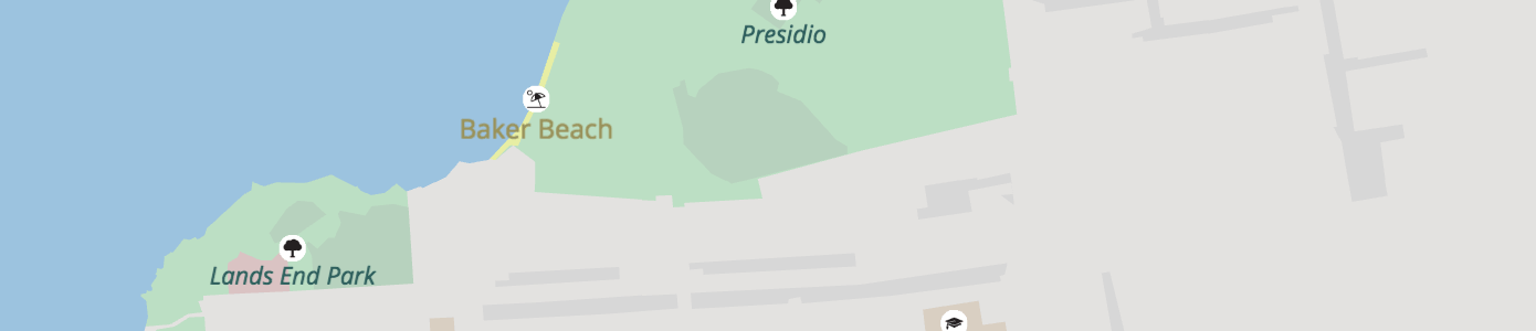
TIP: Some landuse features only exist as point features in OpenStreetMap. Find those in the pois layer.
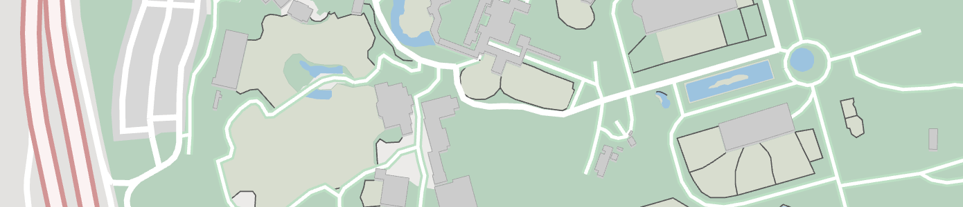
(below) Fence lines around the petting zoo in San Francisco are included in the landuse layer.
Landuse properties (common):
nameid: From OpenStreetMap or Natural Earth. Dropped at low- and mid-zooms when features are merged.kind: combination of thelanduse,leisure,natural,highway,aeroway,amenity,tourism,zoo,attraction,man_made,power, andboundaryOSM tags, orurban_areafor Natural Earth features. Also includes of somebarrierandwaterwaytags:city_wall(zoom 12+),dam(zoom 12+),power_line(zoom 14+),retaining_wall,snow_fence(zoom 15+),crane,fence,gate,wall(zoom 16+ only), andpower_minor_line(zoom 17+).source:openstreetmap.orgornaturalearthdata.comsort_rank: a suggestion for which order to draw features. The value is an integer where smaller numbers suggest that features should be "behind" features with larger numbers.area: in square meters (spherical Mercator, no real-world),polygonfeatures onlymin_zoom: a suggestion for which zoom to draw a feature. The value is a float.
Landuse properties (common optional):
protect_class: Common values include:1,2,3,4,5,6. See OSM wiki for more information.operator: e.g.United States National Park Service,United States Forest Service,National Parks & Wildlife Service NSW.mooring: Common values include:no,yes,commercial,cruise,customers,declaration,ferry,guest,private,public,waiting,yachtoryachts.
Landuse kind values:
aerodrome- withkind_detailinpublic,private,military_public,airfield,international,regional,gliding. And optionalpassenger_countgiving the number of passengers through the aerodrome per year.airfieldallotmentsamusement_rideanimalapronaquariumartworkattractionaviarybare_rockbarren- Only used at mid and low zooms, see "Low zoom consolidation" below.battlefieldbeach- Where the land meets the sea gradually.boatyard- a place for building, fixing, and storing boats.breakwaterbridgecamp_sitecaravan_sitecarouselcemeterywithkind_detailanddenominationproperties.cinemacity_wallcollegecommercialcommoncontainer_terminalcranecutlinecutting- A lowered area of land, usually to carry a road or railway.dam- polygon, linedanger_area- e.g: military training zones, firing ranges.desertdikeditchline.dog_parkembankment- A raised area of land, usually to carry a road or railway.enclosurefarmfarmlandfarmyardfencewithkind_detailproperty.ferry_terminalfootwayforestwithkind_detailproperty.fortfuelgardengategeneratorglaciergolf_coursegrassgrasslandgrave_yardwithkind_detailanddenominationproperties.groyneguard_railline.hanamiharbourheathhospitalindustrialkerbline.landlibrarylow_emission_zone- An area beloging to a low emission zone, such as the London Low Emission Zone. Check also the OSM wiki.mazemeadowmilitarymud- An area where the surface is bare mud.national_parknatural_forestnatural_parknatural_woodnature_reservenaval_baseorchard- An area intentionally planted with trees or shrubs for their crops, rather than their wood. Withkind_detailproperty.parkparkingpedestrianpetting_zoopicnic_sitepierwith mooring property.pitchplace_of_worshipplant_nursery- Land used for growing young plants.plantplaygroundport_terminalportpower_lineline.power_minor_lineline.prisonprotected_areaquarryquaywith mooring property.railwayrange- e.g: military training zones where soldiers practice with their weaponsrecreation_groundrecreation_trackresidentialresortrest_arearetailretaining_wallrockroller_coasterrunwayruralsandschoolscreescrubservice_areashingleshipyardsnow_fencesports_centrestadiumstonesubstationsummer_toboggantaxiwaytheatretheme_parktowertrail_riding_stationuniversityurban_area- Only used at mid and low zooms, see "Low zoom consolidation" below.urbanvillage_greenvineyardwallline withkind_detailproperty.wastewater_plantwater_parkwater_slidewater_workswetlandwithkind_detailproperty.wharfwilderness_hutwildlife_parkwinerywinter_sportswoodwithkind_detailproperty.workszoo
Beach kind_detail values:
If known, kind_detail gives the surface type, one of: grass, gravel, pebbles, pebblestone, rocky, sand.
Cemetery and grave_yard kind_detail values:
The value of the OpenStreetMap religion tag is used for kind_detail on cemetery and grave_yard features. Common values include animist, bahai, buddhist, caodaism, catholic, christian, confucian, hindu, jain, jewish, multifaith, muslim, pagan, pastafarian, scientologist, shinto, sikh, spiritualist, taoist, tenrikyo, unitarian_universalist, voodoo, yazidi, and zoroastrian.
NOTE: A denomination attribute is also available with the value of the OpenStreetMap denomination tag. Common values include adventist, anglican, armenian_apostolic, assemblies_of_god, baptist, buddhist, bulgarian_orthodox, catholic, christian, church_of_scotland, episcopal, evangelical, greek_catholic, greek_orthodox, iglesia_ni_cristo, jehovahs_witness, lutheran, mennonite, methodist, mormon, new_apostolic, nondenominational, orthodox, pentecostal, presbyterian, protestant, quaker, reformed, roman_catholic, romanian_orthodox, russian_orthodox, salvation_army, serbian_orthodox, seventh_day_adventist, shia, shingon_shu, sunni, theravada, tibetan, united, united_methodist, united_reformed, uniting, and 曹洞宗.
Fence kind_detail values:
The value of the OpenStreetMap fence_type tag. Common values include avalanche, barbed_wire, bars, brick, chain, chain_link, concrete, electric, hedge, metal, metal_bars, net, pole, railing, split_rail, stone, wall, wire, and wood.
Wall kind_detail values:
The value of the OpenStreetMap wall tag. Common values include brick, castle_wall, concrete, dry_stone, drystone, flood_wall, gabion, jersey_barrier, noise_barrier, pise, retaining_wall, seawall, stone, and stone_bank.
Wetland kind_detail values:
The value of the OpenStreetMap wetland tag. If available, value will be one of: bog, fen, mangrove, marsh, mud, reedbed, saltern, saltmarsh, string_bog, swamp, tidalflat, wet_meadow.
Wood and forest kind_detail values
- The value of the OpenStreetMap
leaf_typetag, whitelisted tobroadleaved,needleleaved,mixedorleafless.
Orchard kind_detail values
The tree or shrub type. Values are: agave_plants, almond_trees, apple_trees, avocado_trees, banana_plants, cherry_trees, coconut_palms, coffea_plants, date_palms, hazel_plants, hop_plants, kiwi_plants, macadamia_trees, mango_trees, oil_palms, olive_trees, orange_trees, papaya_trees, peach_trees, persimmon_trees, pineapple_plants, pitaya_plants, plum_trees, rubber_trees, tea_plants, and walnut_trees.
Low zoom consolidation
At zoom 12 and below, we consolidate some landuse kinds to reduce the amount of superfluous detail and give adjacent landuse areas a better chance to merge together. This merging allows them to form an appropriately-sized polygon for the zoom level, and avoid the "billion colour patchwork" that comes from keeping each distinct feature.
The current mappings are:
airfield->aerodromeallotments->urban_areaartwork->urban_areaattraction->urban_areabare_rock->desertcollege->universitycommercial->urban_areacommon->grasslanddam->barrendanger_area->militaryfarm->farmlandfort->urban_areagenerator->urban_areagrass->grasslandheath->grasslandindustrial->urban_arealand->barrenmeadow->grasslandmud->wetlandnatural_wood->forestorchard->farmlandpitch->urban_areaplace_of_worship->urban_areaplant->urban_areaplant_nursery->farmlandprison->urban_areaquarry->barrenrailway->urban_arearange->militaryresidential->urban_arearetail->urban_arearock->barrensand->desertscree->barrenscrub->grasslandshingle->barrenstone->barrenvillage_green->urban_areavineyard->farmlandwastewater_plant->urban_areawater_works->urban_areawood->forestworks->urban_area
Places
- Layer name:
places - Geometry types:
point
Combination of OpenStreetMap place points, Natural Earth populated places, and Who's On First neighbourhoods.
Places with kind values of continent, country, with others added starting at zoom 4 for region and starting at zoom 8 for locality. Specific locality and region types are added to the kind_detail tag.
Neighbourhoods: Who's On First neighbourhood and macrohood features are added starting at zoom 12. Neighbourhoods are included one zoom earlier than their min_zoom, and stay included 1 zoom past their max_zoom.
Place properties (common):
nameid: Theosm_idfrom OpenStreetMap or Natural Earth idkind: normalized values between OpenStreetMap and Natural Earthpopulation: population integer values from OpenStreetMap or Natural Earth's maximum population value.population_rank: A value from 18 down to 0, indicating how large the population is on a particular place. A larger value indicates a bigger population. See "Population Rank" below for more details.source:openstreetmap,naturalearthdata.com, orwhosonfirst.orgmin_zoom: a suggested minimum zoom at which the place should become visible based on scalerank and population values from Natural Earth, and invented for OpenStreetMap. Note that this is not an integer, and may contain fractional parts.
Place properties (common optional):
country_capital: atruevalue normalizes values between OpenStreetMap and Natural Earth for kinds ofAdmin-0 capital,Admin-0 capital alt, andAdmin-0 region capital.country_capital:xx: when present, eithertrueorfalseto override thecountry_capitalvalue for XX's viewpoint. Note that the viewpoints are either lower-case ISO 3166-1 alpha-2 codes or the pseudo-codeiso, same as forkind:xxon boundaries.region_capital: atruevalue normalizes values between OpenStreetMap and Natural Earth for kinds ofAdmin-1 capitalandAdmin-1 region capital.region_capital:xx: when present, eithertrueorfalseto override theregion_capitalvalue for XX's viewpoint. Note that the viewpoints are either lower-case ISO 3166-1 alpha-2 codes or the pseudo-codeiso, same as forkind:xxon boundaries.max_zoom: a suggested maximum zoom beyond which the place should not be visible. Currently neighbourhoods only, from Who's On First.is_landuse_aoi: Currently neighbourhoods only, from Who's On Firstkind_detail: the original value of the OSMplacetag and Natural Earthfeaturecla, see below.wikidata_id: when present, the Wikidata ID corresponding to this feature.
Place kind values:
boroughcountrylocalitymacrohoodmicrohoodneighbourhoodregion
Place kind_detail values:
Primarily these are available for features of kind locality or region.
cityfarmhamletisolated_dwellinglocalityprovincescientific_stationstatetownvillage
Population Rank
The values of population rank are derived from the population value as follows:
- 18: Over 1b
- 17: 100m to 1b
- 16: 50m to 100m
- 15: 20m to 50m
- 14: 10m to 20m
- 13: 5m to 10m
- 12: 1m to 5m
- 11: 500k to 1m
- 10: 200k to 500k
- 9: 100k to 200k
- 8: 50k to 100k
- 7: 20k to 50k
- 6: 10k to 20k
- 5: 5k to 10k
- 4: 2k to 5k
- 3: 1k to 2k
- 2: 200 to 1k
- 1: Less than 200
- 0: No
populationvalue available.
Points of Interest
- Layer name:
pois - Geometry types:
point
Over 400 points of interest (POI) kinds are supported. POIs are included starting at zoom 4 for national_park, zoom 9 for park, and zoom 12 for other major features like airport, hospital, zoo, and motorway_junction. Progressively more features are added at each additional zoom based on a combination of feature area (if available) and kind value. For instance, by zoom 15 most police, library, university, and beach features are included, and by zoom 16 things like car_sharing, picnic_site, and tree are added. By zoom 16 all local features are added, like amusement_ride, atm, and bus_stop, but may be marked with a min_zoom property to suggest at which zoom levels they are suitable for display. For example, bench and waste_basket features may be marked min_zoom: 18 to suggest that they are displayed at zoom 18 and higher. Note that min_zoom is not an integer, and may contain a fractional component.
NOTE: The pois layer includes point "labels" for most polygon features otherwise found in the landuse layer (eg: national_park and park); these points are suitable for drawing as icon-and-text labels. The remaining label_position points in the landuse layer and buildings layer are suitable for text-only labels.
Points of interest from OpenStreetMap, with per-zoom selections similar to the primary openstreetmap.org carto stylesheet.
The range of kinds has expanded to cover nearly all of the basic OpenStreetMap.org cartography, iD editor preset icons, Maki icons, Humanitarian OpenStreetMap Team's map style, and more. Icons are provided in the related Mapzen icon library project.
Features from OpenStreetMap which are tagged disused=* for any other value than disused=no are not included in the data. Features which have certain parenthetical comments after their name are suppressed until zoom 17 and have their kind property set to that comment. Currently anything with a name ending in '(closed)' or '(historical)' will be suppressed in this manner. Railway stops, halts, stations and tram stops from OpenStreetMap tagged with a historic tag are also not included in the data.
To resolve inconsistency in data tagging in OpenStreetMap we normalize several operator values for United States National Parks as United States National Park Service, several United States Forest Service values as United States Forest Service, and several values for New South Wales National Parks in Australia as National Parks & Wildlife Service NSW.
POI properties (common):
nameidsource:openstreetmap.orgkind: combination of theaerialway,aeroway,amenity,attraction,barrier,craft,highway,historic,leisure,lock,man_made,natural,office,power,railway,rental,shop,tourism,waterway, andzootags. Can also be one ofclosedorhistoricalif the original feature was parenthetically commented as closed or historical.min_zoom: a suggested minimum zoom at which the POI should become visible. Note that this is not an integer, and may contain fractional parts.
POI properties (common optional):
kind_detail: cuisine, sportattraction: TODOexit_to: only for highway exitsref: generally only foraeroway_gateandstation_entrancefeaturesreligion: TODOwikidata_id: when present, the Wikidata ID corresponding to this feature.zoo: TODO
POI properties (only on kind:station):
state: only onkind:station, status of the station. Values include:proposed,connection,inuse,alternate,temporary.*_routes: a list of the reference name/number or full name (if there is noref) of the OSM route relations which are reachable by exploring the local public transport relations or site relations. These are:train_routesa list of train routes, generally above-ground and commuter or inter-city "heavy" rail.subway_routesa list of subway or underground routes, generally underground commuter rail.light_rail_routesa list of light rail or rapid-transit passenger train routes.tram_routesa list of tram routes.is_*a set of boolean flags indicating whether this station has any routes of the given type. These are:is_train,is_subway,is_light_rail,is_tram, corresponding to the above*_routes. This is provided as a convenience for styling.root_idan integer ID (of an OSM relation) which can be used to link or group together features which are related by being part of a larger feature. A full explanation of relations wouldn't fit here, but the general idea is that all the station features which are part of the same site, stop area or stop area group should have the same ID to show they're related. Note that this information is only present on some stations.
POI properties (only on kind:bicycle_rental_station):
capacity: Approximate number of total rental bicycles at the bike share station.network: The common (sometimes branded) name of the bike share network, eg: "Citi Bike".operator: Who actually runs the bike share station, eg: "NYC Bike Share".ref: The reference of this rental station, if one is available.
POI properties (only on kind:bicycle_parking and kind:motorcycle_parking):
access: Whether the parking is for general public use (yes,permissive,public) or for customers only (customers) or private use only (private,no).capacity: Approximate number of total bicycle parking spots.covered: Is the parking area covered.fee: If present, indicates whether a fee must be paid to use the parking. A value oftruemeans a fee must be paid, a value offalsemeans no fee is required. If the property is not present, then it is unknown whether a fee is required or not.operator: Who runs the parking lot.maxstay: A duration indicating the maximum time a bike is allowed to be parked.surveillance: If present, then indicates whether there is surveillance. A value oftruemeans the parking is covered by surveillance, a value offalsemeans it is not. If the property is not present, then it is unknown whether surveillance is in place or not.
POI properties (only on kind:peak and kind:volcano):
elevation: Elevation of the peak or volcano in meters, where available.kind_tile_rank: A rank of each peak or volcano, with 1 being the most important. Both peaks and volcanos are scored in the same scale. When the zoom is less than 16, only five of these features are included in each tile. At zoom 16, all the features are - although it's rare to have more than 5 peaks in a zoom 16 tile.
POI properties (only on kind:marina, kind:camp_site and kind:caravan_site)
sanitary_dump_station: One ofyes,customersorpublicif there are sanitary dump facilities at this location, and who is permitted to use them.
POI properties (only on charging_station):
bicycle,scooter,car,truck: True, false, or omitted based on if that type of vehicle can be charged, or if the information is not present
POI properties (only on quary, wharf):
mooringwith values:no,yes,commercial,cruise,customers,declaration,ferry,guest,private,public,waiting,yachtoryachts.
POI kind values:
accountantaditadministrativeadult_gaming_centreadvertising_agencyaerodrome- withkind_detailinpublic,private,military_public,airfield,international,regional,gliding. And optionalpassenger_countgiving the number of passengers through the aerodrome per year.aeroway_gateairfieldfor military use.airportalcoholalpine_hutambulatory_careamusement_rideanimalaquariumarchaeological_sitearchitectartarts_centre- A venue where arts are performed or exhibited.artworkassisted_livingassociationatmattractionatvaviarybaby_hatchbakerybankbarbattlefieldbbqbeach_resortbeach- Where the land meets the sea gradually. Withkind_detailproperty.beaconbeautybed_and_breakfastbenchbicycle_junction- Common in Europe for signed bicycle routes with named junctions. The cycle network reference point'srefvalue is derived from one oficn_ref,ncn_ref,rcn_reforlcn_ref, in descending order and is suitable for naming or use in a shield.bicycle_parkingbicycle_rental_station- Bike share station offering free or low cost bicycle rentals as part of a public bike scheme.bicycle_rental- Bicycle rental shop.bicycle_repair_stationbicycle- Bicycle sales shop, often with bike repair service.biergartenblockblood_bankboat_liftboat_rentalboat_storageboatyard- a place for building, fixing, and storing boats.bollardbookmakerbooksborder_controlbrewerybunker- A reinforced military building. Withkind_detailproperty.bureau_de_changebus_stationbus_stopbutchercafecamera- A shop selling cameras.camp_sitecar_parts- A shop selling car parts.car_rental- A business which rents cars.car_repaircar_sharingcar_washcarcaravan_sitecare_homecarouselcarpentercasino- A venue for gambling.cattle_gridbarriercave_entrancecemeterywithkind_detailanddenominationproperties.chainbarrierchaletcharging_station- May also havebicycle,scooter,car, andtruckset to true or falsecharity- A shop selling items, often second-hand clothes, in order to raise money for charity.chemist- A shop selling household chemicals, often including soaps, toothpaste and cosmetics.childcarechildrens_centrechiropractorcinemaclinicwithkind_detailproperty.closed. See planned bug fix in #1026.clothesclubcoffeecollegecommunications_towercommunity_centrecompanycomputerconfectioneryconsultingcontainer_terminalconveniencecopyshop- A shop offering photocopying and printing services.cosmetics- A specialty shop selling cosmetics.courthousecraft- A shop or workshop producing craft items. Used when the POI doesn't match a more specific craft, such asbrewery,carpenter,confectionery,dressmaker, etc...cranewithkind_detailproperty.crosscustoms- A place where border control is carried out, which may involve customs taxes.cycle_barrier- Barrier for bicycles.dairy_kitchendamdanger_area- e.g: military training zones, firing ranges.day_caredefibrillatordelidentistwithkind_detailproperty.department_storedispensarydive_centredoctorswithkind_detailproperty.dog_parkdoityourselfdressmakerdrinking_waterdry_cleaningduneeducational_institutionegresselectricianelectronicselevator- An enclosure for vertical travel.embassyemergency_phoneemployment_agencyenclosure- at a zooestate_agentfarmfashionfast_foodferry_terminalfield_hospitalwithkind_detailproperty.financialfire_hydrantfire_stationfirepitfishing_areafishingfishmonger- A shop selling fish and seafood.fitness_stationfitnessfloristfood_bankfordforestfortfoundationfuel- Fuel stations provide liquid gas (or diesel) for automotive use.funeral_directors- A venue offering funerary services.furnituregallery- An art gallery.gamblinggarden_centregardengardenergas_canister- Shop selling bottled gas for cooking. Some offer gas canister refills.gatewithkind_detailproperty.generator- A building or structure which generates power. Withkind_detailproperty.geysergiftgolf_coursegolf- Shop selling golf equipment.governmentgrave_yardwithkind_detailanddenominationproperties.greengrocer- Shop selling fruits and vegetables.grocery- Shop selling non-perishable food often similar to, but smaller than, asupermarket. See also grocery store on Wikipedia.group_homeguest_househairdresserhalthanamihandicraftharbourmasterhardwarehazardhealth_centrehealthcare_alternativehealthcare_centrehealthcare_laboratoryhealthcarewithkind_detailproperty.helipadheliporthifihistorical– See planned bug fix in #1026.horse_ridinghospicehospitalwithkind_detailproperty.hostelhot_springhotelhunting_standhuntinghvacice_cream- See planned bug fix in #532.industrial- An industrial POI which didn't match a more specific kind.informationinsuranceitjewelrykaraoke_boxkaraokekindergartenlandmarklaundrylawyerlevel_crossinglibrarylife_ringlifeguard_towerlighthouselocklottery- A shop selling lottery tickets.love_hotelmallmarinamarketplacemastmazememorialmetal_constructionmidwifemilitarymineshaftmini_roundabout- has optional propertydrives_on_leftto indicate whether the roundabout is in a country which drives on the left (drives_on_left=true) and therefore goes around the mini roundabout in a clockwise direction as seen from above. The property is omitted when the country drives on the right and has counter-clockwise mini roundabouts (i.e: defaultfalse).miniature_golf- A venue for playing miniature golf.mobile_phonemoney_transfer- A business which specialises in transferring money between people, often internationally.monumentmooringwithkind_detailproperty.motelmotorcycle_parkingmotorcyclemotorway_junctionmuseummusicnational_parknature_reservenaval_basenewsagentnewspaperngonightclubnotarynursing_homewithkind_detailproperty.obelisk- A tall structure, usually a monument or memorial. If known, thekind_detailwill be set to eithermonumentormemorial.observatoryoccupational_therapistoffice- An office which didn't match a more specific kind.offshore_platformopticianoptometristorchard- An area intentionally planted with trees or shrubs for their crops, rather than their wood. Optionalkind_detailproperty.outdooroutreachpaediatricspainterparkparking_garageparking type ismulti-storey,underground, orrooftop.parkingpeakA mountain peak. See above for properties available on peaks and volcanos.perfumerypetpetroleum_wellpetting_zoopharmacywithkind_detailproperty.phonephoto- A shop offering photograph processing services, e.g: developing or mounting.photographerphotographic_laboratoryphysicianphysiotherapistpicnic_sitepicnic_tablepitch- Withkind_detailoptionally describing the sport. Common values arebaseball,basketball,football,hockey,soccer,tennis`.place_of_worshipplantplaque- A memorial plaque.playgroundplumberpodiatristpolicepolitical_partyport_terminalpost_boxpost_officepotterypower_polepower_towerpower_windprisonprotected_areapsychotherapistpubput_in_egressput_inpylonquarryquay- if available, withmooringproperty.range- e.g: military training zones where soldiers practice with their weaponsranger_stationrapidrecreation_groundrecreation_trackrecyclingrefugee_camprehabilitationreligionresearchresidential_homeresortrest_arearestaurantrockroller_coastersaddlesanitary_dump_stationsawmillschoolscuba_divingservice_areasheltership_chandlershipyardshoemakershoesshop- A shop or store which didn't match a more specific kind.showersinkholeski_rentalski_schoolskislaughterhouseslipwaysnow_cannonsnowmobilesocial_facilitywithkind_detailproperty.soup_kitchenspeech_therapistsports_centresportsspringstadiumstation- See planned bug fix in #532.stationerystonestonemasonstreet_lampstudio- A specialised location for making audio or video recordings. If known, the type will be inkind_detail, one of:audio,cinema,photography,radio,television,video.substationsubway_entrancesummer_campsummer_toboggansupermarketswimming_areatailortax_advisortaxifor taxi stands.telecommunicationtelephonetelescopetheatretheme_parktherapisttobaccotoiletswithkind_detailproperty.toll_boothtownhalltoystradetraffic_signalstrail_riding_stationtrailheadtram_stoptravel_agencytravel_agenttreeturning_circleturning_looptyres- A shop selling car tyres or tires.universityvariety_storeveterinarywithkind_detailproperty.viewpointvolcanoThe peak of a volcano. See above for properties available on peaks and volcanos.walking_junction- Common in Europe for signed walking routes with named junctions. The walking network reference point'srefvalue is derived from one ofiwn_ref,nwn_ref,rwn_reforlwn_ref, in descending order and is suitable for naming or use in a shield.waste_basketwaste_disposalwastewater_plantwater_parkwater_pointwater_slidewater_towerwater_well- A location where water can be extracted from the ground. Withkind_detailproperty.water_workswaterfallwatering_placewatermill- A structure for using water power to do work. Note that this is different from a modern structure to generate electric power from water, which would be agenerator. Abandoned or disused features are not shown unless they are attractions, landmarks or other kinds.waterway_fuelwayside_crosswetlandwithkind_detailproperty.wharfwith mooring property.wilderness_hutwildlife_parkwindmillwinewinery- See planned bug fix in #532.winter_sportswoodworksworkshopzoo
Beach kind_detail values:
The value of the OpenStreetMap surface tag. Common values include grass, gravel, pebbles, pebblestone, rocky, and sand.
Bunker kind_detail values:
Where known, the kind_detail will be one of: blockhouse, gun_emplacement, hardened_aircraft_shelter, mg_nest, missile_silo, munitions, pillbox, technical.
Cemetery and grave_yard kind_detail values:
The value of the OpenStreetMap religion tag is used for kind_detail on cemetery and grave_yard features. Common values include animist, bahai, buddhist, caodaism, catholic, christian, confucian, hindu, jain, jewish, multifaith, muslim, pagan, pastafarian, scientologist, shinto, sikh, spiritualist, taoist, tenrikyo, unitarian_universalist, voodoo, yazidi, and zoroastrian.
NOTE: A denomination attribute is also available with the value of the OpenStreetMap denomination tag. Common values include adventist, anglican, armenian_apostolic, assemblies_of_god, baptist, buddhist, bulgarian_orthodox, catholic, christian, church_of_scotland, episcopal, evangelical, greek_catholic, greek_orthodox, iglesia_ni_cristo, jehovahs_witness, lutheran, mennonite, methodist, mormon, new_apostolic, nondenominational, orthodox, pentecostal, presbyterian, protestant, quaker, reformed, roman_catholic, romanian_orthodox, russian_orthodox, salvation_army, serbian_orthodox, seventh_day_adventist, shia, shingon_shu, sunni, theravada, tibetan, united, united_methodist, united_reformed, uniting, and 曹洞宗.
Crane kind_detail values:
Common values include: container_crane, floor_mounted_crane, gantry_crane, portal_crane, travellift.
See planned fix in https://github.com/tilezen/vector-datasource/issues/1597.
Clinic, dentist, doctors, field_hospital, healthcare, hospital, nursing_home, pharmacy, social_facility, and veterinary kind_detail values:
Indicate heath care facility type, common values include: office, dispensary, clinic, laboratory, health_centre, hospital, health_center, CSCom, first_aid, pharmacy, chemist_dispensing, counselling_centre, medical_clinic.
Gate kind_detail values:
One of chain, gate, kissing_gate, lift_gate, stile, swing_gate.
Generator kind_detail values:
The value of the OpenStreetMap generator:source tag or, if that tag is missing, an interpolation from the generator:method tag. Common values include biofuel, biogas, biomass, coal, diesel, gas, geothermal, hydro, nuclear, oil, solar, waste, wind.
Mooring kind_detail values:
A place to tie up a boat. If available, with kind_detail one of commercial, cruise, customers, declaration, ferry, guest, pile, private, public, waiting, yacht or yachts.
Orchard kind_detail values:
Common values include: agave_plants, almond_trees, apple_trees, avocado_trees, banana_plants, cherry_trees, coconut_palms, coffea_plants, date_palms, hazel_plants, hop_plants, kiwi_plants, macadamia_trees, mango_trees, oil_palms, olive_trees, orange_trees, papaya_trees, peach_trees, persimmon_trees, pineapple_plants, pitaya_plants, plum_trees, rubber_trees, tea_plants, and walnut_trees.
Toilet kind_detail values:
Common values include pit_latrine, flush, chemical, pour_flush, bucket.
water_well kind_detail values:
Common values include: drinkable_powered, drinkable_manual, drinkable_no_pump, drinkable, not_drinkable_powered, not_drinkable_manual, not_drinkable_no_pump, not_drinkable.
Wetland kind_detail values
The value of the OpenStreetMap wetland tag. If available, value will be one of: bog, fen, mangrove, marsh, mud, reedbed, saltern, saltmarsh, string_bog, swamp, tidalflat, wet_meadow.
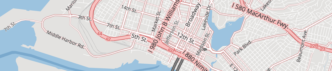
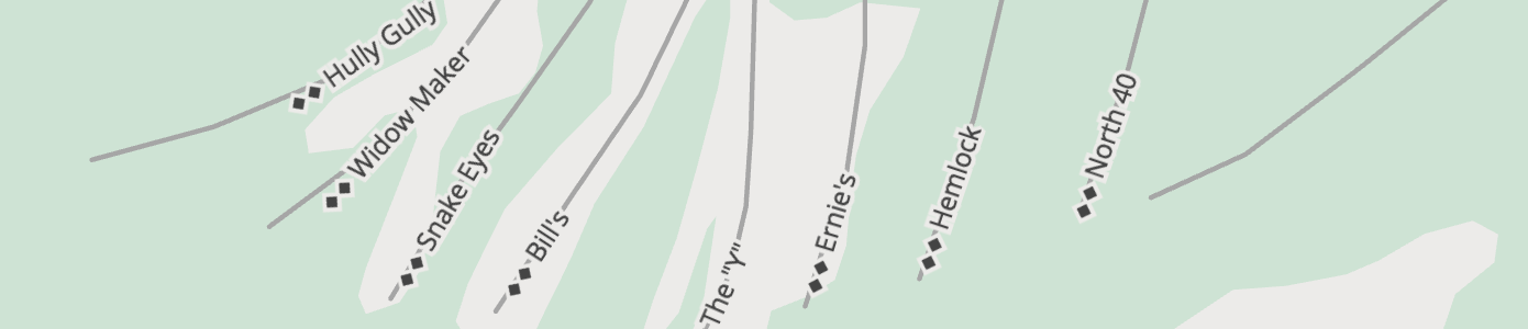
Roads (Transportation)
- Layer name:
roads - Geometry types:
line,point
More than just roads, this OpenStreetMap and Natural Earth based transportation layer includes highways, major roads, minor roads, paths, railways, ferries, and ski pistes matching the selection found in High Road. Sort them with sort_rank to correctly represent layered overpasses, bridges and tunnels. Natural Earth roads at zooms < 8 and OpenStreetMap at zooms 8+. See zoom ranges section below for more information per kind.
Road names are abbreviated so directionals like North is replaced with N, Northeast is replaced with NE, and common street suffixes like Avenue to Ave. and Street to St.. Full details in the StreetNames library.
Tilezen calculates the landuse_kind value by intercutting roads with the landuse layer to determine if a road segment is over a parks, hospitals, universities or other landuse features. Use this property to modify the visual appearance of roads over these features. For instance, light grey minor roads look great in general, but aren't legible over most landuse colors unless they are darkened.
To improve performance, some road segments are merged at low and mid-zooms. To facilitate this, certain properties are dropped at those zooms. Examples include is_bridge and is_tunnel, name, network, oneway, and ref. The exact zoom varies per feature class (major roads keep this properties over a wider range, minor roads drop them starting at zoom 14). When roads are merged, the original OSM id values are dropped.
Road properties (common):
name: From OpenStreetMap, but transformed to abbreviated names as detailed above.id: From OpenStreetMap or Natural Earth. Dropped at low- and mid-zooms when features are merged. See planned bug fix #1002.source:openstreetmapornaturalearthdata.comkind: one of High Road's values forhighway,major_road,minor_road,rail,path,ferry,piste,aerialway,aeroway,racetrack,portage_way,construction.kind_detail: See kind detail list below, sourced from the OpenStreetMap values.landuse_kind: See description above, values match values in thelanduselayer.sort_rank: a suggestion for which order to draw features. The value is an integer where smaller numbers suggest that features should be "behind" features with larger numbers. At zooms >= 15, thesort_rankis adjusted to realistically model bridge, tunnel, and layer ordering.min_zoom: a suggestion for which zoom to draw a feature. The value is a float.ref: Commonly-used reference for roads, for example "I 90" for Interstate 90. To use with shields, seenetworkandshield_text. Related, seesymbolfor pistes.all_networksandall_shield_texts: All the networks of which this road is a part, and all of the shield texts. Seenetworkandshield_textbelow. Note that these properties will not be present on MVT format tiles, as we cannot currently encode lists as values.network: eg:US:Ifor the United States Interstate network, useful for shields and road selections. This only contains road network types. Please seebicycle_networkandwalking_networkfor bicycle and walking networks, respectively. Note that networks may include "modifier" information, for exampleUS:I:Businessfor a business route orUS:I:Truckfor a truck route. The whitelist of "modifier" values is;Alternate,Business,Bypass,Connector,Historic,Scenic,Spur,TollandTruck.shield_text: Contains text to display on a shield. For example, I 90 would have anetworkofUS:Iand ashield_textof90. Theref,I 90, is less useful for shield display without further processing. For some roads, this can include non-numeric characters, for example the M1 motorway in the UK will have ashield_textofM1, rather than just1. Whitepsace, punctuation, and prefixes are generally stripped.
Road properties (common optional):
cycleway:cyclewaytag from feature. If nocyclewaytag is present butcycleway:bothexists, we source from that tag instead.cycleway_left:cycleway_lefttag from featurecycleway_right:cycleway_righttag from featuresidewalk:sidewalktag from feature. If nosidewalktag is present butsidewalk:bothexists, we source from that tag instead.sidewalk_left:sidewalk:lefttag from featuresidewalk_right:sidewalk:righttag from featureferry: See kind list below.footway: sidewalk or crossingis_bicycle_related: Present andtruewhen road features is a dedicated cycleway, part of an OSM bicycle network route relation, or includes cycleway infrastructure like bike lanes, or tagged bicycle=yes or bicycle=designated for shared use.is_bridge:trueif the road is part of a bridge. The property will not be present if the road is not part of a bridge.is_bus_route: If present andtrue, then buses or trolley-buses travel down this road. This property is determined based on whether the road is part of an OSM bus route relation, and is only present on roads at zoom 12 and higher.is_link:trueif the road is part of a highway link or ramp. The property will not be present if the road is not part of a highway link or ramp.is_tunnel:trueif the road is part of a tunnel. The property will not be present if the road is not part of a tunnel.leisure: See kind list below.man_made: See kind list below.oneway_bicycle:oneway:bicycletag from feature. See bug fix planned in #1028.oneway:yesorno. See bug fix planned in #1028.segregated: Set totruewhen a path allows both pedestrian and bicycle traffic, but when pedestrian traffic is segregated from bicycle traffic.service: See value list below, provided forrailwayandkind_detail=serviceroads.all_walking_networksandall_walking_shield_texts: All of the walking networks of which this road is a part, and each corresponding shield text. Seewalking_networkandwalking_shield_textbelow. Note that these properties will not be present on MVT format tiles, as we cannot currently encode lists as values.walking_network: e.g:nwnfor a "National Walking Network". Other common values includeiwnfor international,rwnfor regional andlwnfor local walking networks.walking_shield_text: Contains text intended to be displayed on a shield related to the walking network. This is the value from thereftag and is not guaranteed to be numeric, or even concise.all_bicycle_networksandall_bicycle_shield_texts: All of the bicycle networks of which this road is a part, and each corresponding shield text. Seebicycle_networkandbicycle_shield_textbelow. Note that these properties will not be present on MVT format tiles, as we cannot currently encode lists as values.bicycle_network: Present if the feature is part of a cycling network. If so, the value will be one oficnfor International Cycling Network,ncnfor National Cycling Network,rcnfor Regional Cycling Network,lcnfor Local Cycling Network.bicycle_shield_text: Contains text intended to be displayed on a shield related to the bicycle network. This is the value from thereftag and is not guaranteed to be numeric, or even concise.all_bus_networksandall_bus_shield_texts: All of the bus and trolley-bus routes of which this road is a part, and each corresponding shield text. Seebus_networkandbus_shield_textbelow. Note that these properties will not be present on MVT format tiles, as we cannot currently encode lists as values.bus_network: Note that this is often not present for bus routes / networks. This may be replaced withoperatorin the future, see issue 1194.bus_shield_text: Contains text intended to be displayed on a shield related to the bus or trolley-bus network. This is the value from thereftag and is not guaranteed to be numeric, or even concise.surface: Common values includeasphalt,unpaved,paved,ground,gravel,dirt,concrete,grass,paving_stones,compacted,sand, andcobblestone.cobblestone:flattened,concrete:platesandconcrete:lanesvalues are transformed tocobblestone_flattened,concrete_platesandconcrete_lanesrespectively. These values are simplified at lower zooms, see the section "Roads surface values simplification" for more details.
Road properties (optional):
ascent: ski pistes from OpenStreetMapaccess:private,yes,no,permissive,customers,destination, and other values from OpenStreetMapbicycle:yes,no,designated,dismount, and other values from OpenStreetMapcutting: If the road or railway is in a cutting the value will be one ofyes,leftorrightdepending on whether the cutting is on both sides, the left side or the right side, respectively.colour: ski pistes from OpenStreetMapdescent: ski pistes from OpenStreetMapdescription: OpenStreetMap featuresdistance: ski pistes from OpenStreetMapembankment: If the road or railway is on an embankment the value will be one ofyes,leftorrightdepending on whether the embankment is on both sides, the left side or the right side, respectively.hgv: optional property indicating general truck heavy goods vehicle truck access. See below for list of values.hgv_restriction: optional property indicating limitations to heavy goods vehicle truck access. See below for list of values. Available on both point and line geometries. See alsohgv_restriction_shield_text.hgv_restriction_shield_text: optional and paired withhgv_restrictionpoints with values like5.1m. Because the units are different per restriction an abbreviation should be provided. Values in meters can be specified with one decimal precision but value of 5.0m should be given as 5m.motor_vehicle: OpenStreetMap featuresoperator: OpenStreetMap featurespiste_difficulty: ski pistes from OpenStreetMappiste_grooming: ski pistes from OpenStreetMappiste_name: ski pistes from OpenStreetMapramp: OpenStreetMap featuresramp_bicycle: OpenStreetMap featuresroundtrip: OpenStreetMap featuresroute_name: OpenStreetMap featuresski: ski pistes from OpenStreetMapsnowshoe: ski pistes from OpenStreetMapsport: OpenStreetMap featuresstate: OpenStreetMap featuressymbol: ski pistes from OpenStreetMaptoll: optionalbooleanvalue indicating whether a fee must be paid by general traffic to travel the feature.toll_hgv: optionalbooleanvalue when tool only applies to certain classes of vehicles like heavy good vehicle trucks.
Road transportation kind values (lines):
aerialwayaerowayconstruction- Indicates that the road is under construction and may not be usable by some or all types of traffic.ferryhighwaymajor_roadminor_roadpathpistequayracetrackrail
Road transportation kind_detail values and zoom ranges:
Roads from Natural Earth are used at low zooms below 8. Road kind_detail values are limited to motorway, trunk, primary, secondary, tertiary.
Roads from OpenStreetMap are shown starting at zoom 8 with motorway, trunk, primary. secondary are added starting at zoom 10, with motorway_link, tertiary, unclassified, and paved grade1 track added at zoom 11. Zoom 12 sees addition of trunk_link, residential, road, and grade1 and grade2 track. Zoom 13 adds primary_link, secondary_link, raceway, remaining track, pedestrian, living_street, cycleway and bridleway. Zoom 14 adds tertiary_link, all remaining path, footway, and steps, corridor, and alley service roads. By zoom 15 all remaining service roads are added, including driveway, parking_aisle, drive_through. Internationally and nationally significant paths (path, footway, steps) are added at zoom 9, regionally significant paths are added at zoom 11, locally significant at zoom 12, and named or designated paths at zoom 13. Internationally and nationally significant bicycle routes are added at zoom 8, regionally significant bike routes at zoom 10, and locally significant at zoom 11.
Ferries from both Natural Earth and OpenStreetMap are shown starting at zoom 5 with kind values of ferry.
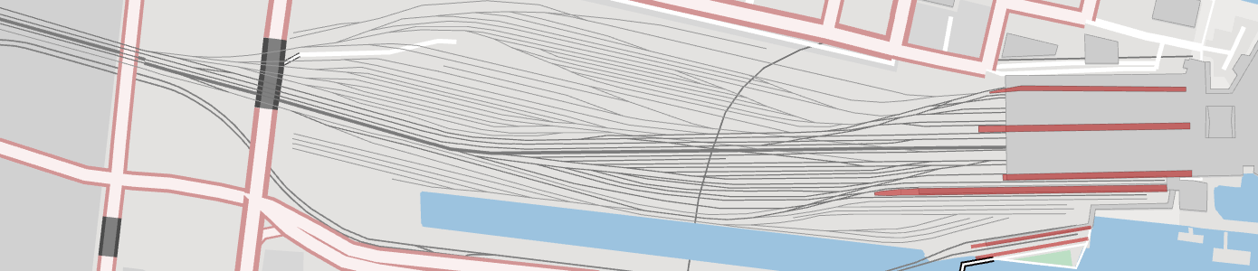
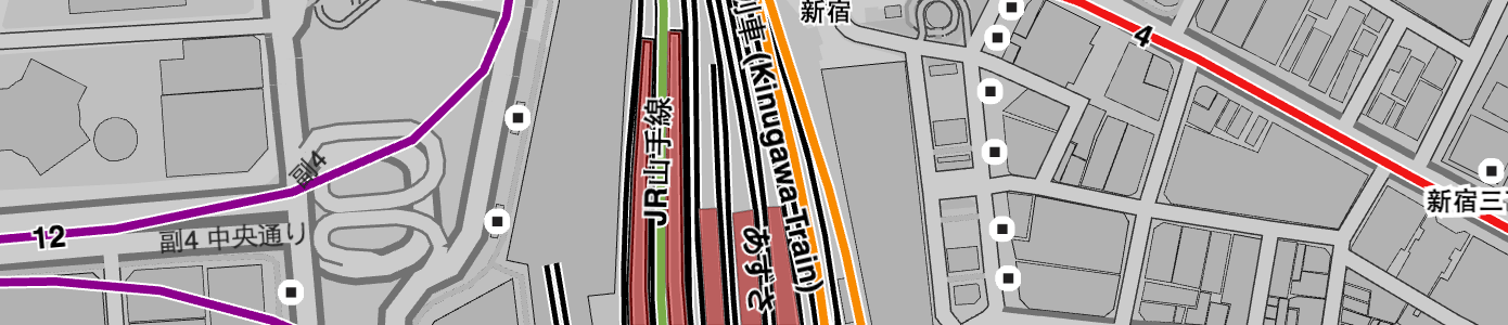
Rail is added starting at zoom 11, with minor railroad spur added at zoom 12+ (based on "service" values), and further detail for yard and crossover and 13 and 14 respectively with all railroads shown by zoom 15. Features for rail tracks are included in this layer, whereas geometries and further information about rail lines or routes is available in the transit layer.
Railway kind_detail values in this layer include: disused, funicular, light_rail, miniature, monorail, narrow_gauge, preserved, rail, subway, tram.
Railway service values are:
spursidingyardcrossoverbranchconnectorwyerunawayinterchangeswitchindustrialdisuseddrivewaypassing_loop
Airport aeroways with kind_detail values of runway show up at zoom 9, with taxiway at zoom 11+.
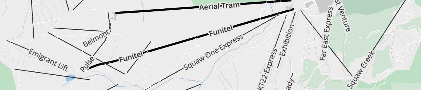
Aerialways with kind_detail values of gondola, cable_car show up zoom 12+. chair_lift is added at zoom 13+, and by zoom 15 all are visible adding drag_lift, platter, t_bar, goods, magic_carpet, rope_tow, zip_line, j_bar, unknown, mixed_lift, and canopy.
Racetrack lines for various recreation tracks start showing up at zoom 14 with kind_detail values of sport_values of athletics, running, horse_racing, bmx, disc_golf, cycling, ski_jumping, motor, karting,obstacle_course, equestrian, alpine_slide, soap_box_derby,mud_truck_racing, skiing, drag_racing, archery.
Piste type with kind_detail values of nordic, downhill, sleigh, skitour, hike, sled, yes, snow_park, playground, ski_jump. Abandoned pistes are not included in tiles.
Piers and quays start showing up at zoom 13+ with kind_detail values of pier and quay, respectively. If mooring information is available, the mooring property will be one of no, yes, commercial, cruise, customers, declaration, ferry, guest, private, public, waiting, yacht or yachts.
Roads hgv values:
The hgv property indicates general truck heavy goods vehicle truck access, values include: no, designated, destination, delivery, local and agricultural.
Roads hgv_restriction values:
For hgv_restriction property indicates general truck heavy goods vehicle truck access restrictions, values (units vary) include: weight (metric tonnes), height (metres), length (metres), width (metres), wpa (weight per axle, in metric tonnes), kpra (king pin to rear axle length, in metric tonnes), hazmat (true if restricted, otherwise omitted), other and multiple if more than one.
Roads layer network values
Any road with shield_text will include a network property with a value like AA:bcdef where AA is a 2-character country code, followed by a : separator, and bcdef category value which either indicates the "region" (state or province) or "level" of the road network. There are exceptions to this for trans-national networks like e-road. In some cases, like the United States and Canada an additional modifier to appended to indicate Truck and other alternate routes, or further network disambiguation.
When a network value can't be determined from the upstream data source we calculate where the road is located and provide the relevant 2-char country code as the network value. See table below for mapping of country codes to country names.
Tilezen normalizes upstream data sources to well known values. While it's common for OpenStreetMap to include road network relations in the United States and Canada, most other countries lack this information and we synthesize Tilezen network values from OpenStreetMap from a combination of network, ref, and country spatial joins.
Network value include:
AM:AMAR:nationalAR:provincialAsianHighwayAT:A-roadAU:A-roadAU:B-roadAU:C-roadAU:M-roadAU:Metro-roadAU:N-routeAU:R-routeAU:S-routeAU:T-driveBE:A-roadBE:N-roadBE:R-roadBR:ACBR:ALBR:AMBR:APBR:BABR:BRBR:CEBR:DFBR:ESBR:GOBR:MABR:MG:localBR:MGBR:MSBR:MTBR:PABR:PBBR:PEBR:PIBR:PRBR:PRBR:RJBR:RNBR:ROBR:RRBR:RSBR:SCBR:SEBR:SP:PLNBR:SP:SCABR:SPBR:TOBR:Trans-AmazonianBRCA:AB:primaryCA:AB:trunkCA:ABCA:BC:primaryCA:BC:trunkCA:BCCA:MB:PTHCA:MBCA:NBCA:NB2CA:NB3CA:NS:RCA:NS:TCA:NS:TCA:NTCA:ON:primaryCA:ON:secondaryCA:PEICA:QC:ACA:QC:RCA:SK:primaryCA:SK:secondaryCA:SK:tertiaryCA:transcanadaCA:yellowheadCA:YTCD:RRIGCH:motorwayCH:nationalCH:regionalCL:nationalCL:regionalCN:expressway:regionalCN:expresswayCN:JXCN:roadCZ:nationalCZ:regionalDE:BABDE:BSDE:Hamburg:RingDE:KSDE:LSDE:STSDEDK:nationale-roadES:A-roadES:autonomaES:cityES:N-roadES:provinceESFR:A-roadFR:D-roadFR:N-roadFRGA:L-roadGA:nationalGB:A-road-greenGB:A-road-whiteGB:B-roadGB:M-roadGBGR:motorwayGR:nationalGR:provincialGRHU:nationalID:nationalIN:MDRIN:NHIN:SHIR:nationalIR:freewayIT:A-roadIT:B-roadITJP:expresswayJP:nationalJP:prefecturalJPKR:expresswayKR:localKR:metropolitanKR:nationalKZ:nationalKZ:regionalLA:nationalMX:AGUMX:BCNMX:BCSMX:CAMMX:CHHMX:CHPMX:CMX:EXTMX:CMX:INTMX:COAMX:COLMX:DURMX:GROMX:GUAMX:HIDMX:JALMX:MEXMX:MICMX:MORMX:NAYMX:NLEMX:OAXMX:PUEMX:QUEMX:ROOMX:SINMX:SLPMX:SONMX:TABMX:TAMMX:VERMX:YUCMX:ZACMY:expresswayMY:federalMY:JHRMY:KDHMY:KTNMY:MLKMY:NSNMY:PHGMY:PLSMY:PNGMY:PRKMY:SBHMY:SGR:municipalMY:SGRMY:SWKMY:TRGNL:A-roadNL:N-roadNO:fylkesveiNO:oslo:ringNO:riksveiNZ:SHNZ:SRPE:AMPE:ANPE:APPE:ARPE:AYPE:CAPE:CUPE:HUPE:HVPE:ICPE:JUPE:LAPE:LIPE:LMPE:LOPE:MDPE:MOPE:PAPE:PEPE:PIPE:PUPE:SMPE:TAPE:TUPE:UCPH:NHNPKPL:expresswayPL:motorwayPL:nationalPL:regionalPT:expressPT:motorwayPT:municipalPT:nationalPT:primaryPT:rapidPT:regionalPT:secondaryPTRO:countyRO:localRO:motorwayRO:nationalRU:nationalRU:regionalSG:expresswayTR:highwayTR:motorwayTR:provincialUA:internationalUA:nationalUA:regionalUA:territorialUS:AKUS:ALUS:ARUS:AZUS:BIAUS:BLMUS:CAUS:COUS:CTUS:DCUS:DEUS:FLUS:FSHUS:FSRUS:GAUS:HIUS:I:AlternateUS:I:BusinessUS:I:BypassUS:I:ConnectorUS:I:HistoricUS:I:ScenicUS:I:SpurUS:I:TollUS:I:TruckUS:IUS:IAUS:IDUS:ILUS:INUS:KSUS:KYUS:LAUS:MAUS:MDUS:MEUS:MIUS:MNUS:MOUS:MSUS:MTUS:NCUS:NDUS:NEUS:NHUS:NJUS:NMUS:NVUS:NYUS:OHUS:OKUS:ORUS:PAUS:RIUS:SCUS:SDUS:TNUS:TXUS:US:AlternateUS:US:BusinessUS:US:BypassUS:US:ConnectorUS:US:HistoricUS:US:ScenicUS:US:SpurUS:US:TollUS:US:TruckUS:USUS:UTUS:VAUS:VTUS:WAUS:WIUS:WVUS:WYVN:expresswayVN:nationalVN:provincialVN:roadZA:krugerZA:metropolitanZA:nationalZA:provincialZA:regionalZA:S-road
Country lookup table:
| Alpha-2 code | Country |
|---|---|
AF |
Afghanistan |
AX |
Åland Islands |
AL |
Albania |
DZ |
Algeria |
AS |
American Samoa |
AD |
Andorra |
AO |
Angola |
AI |
Anguilla |
AQ |
Antarctica |
AG |
Antigua and Barbuda |
AR |
Argentina |
AM |
Armenia |
AW |
Aruba |
AU |
Australia |
AT |
Austria |
AZ |
Azerbaijan |
BS |
Bahamas |
BH |
Bahrain |
BD |
Bangladesh |
BB |
Barbados |
BY |
Belarus |
BE |
Belgium |
BZ |
Belize |
BJ |
Benin |
BM |
Bermuda |
BT |
Bhutan |
BO |
Bolivia |
BQ |
Bonaire, Sint Eustatius and Saba |
BA |
Bosnia and Herzegovina |
BW |
Botswana |
BV |
Bouvet Island |
BR |
Brazil |
IO |
British Indian Ocean Territory |
BN |
Brunei Darussalam |
BG |
Bulgaria |
BF |
Burkina Faso |
BI |
Burundi |
CV |
Cabo Verde |
KH |
Cambodia |
CM |
Cameroon |
CA |
Canada |
KY |
Cayman Islands |
CF |
Central African Republic |
TD |
Chad |
CL |
Chile |
CN |
China |
CX |
Christmas Island |
CC |
Cocos (Keeling) Islands |
CO |
Colombia |
KM |
Comoros |
CG |
Congo |
CD |
Democratic Republic of the Congo |
CK |
Cook Islands |
CR |
Costa Rica |
CI |
Côte d'Ivoire |
HR |
Croatia |
CU |
Cuba |
CW |
Curaçao |
CY |
Cyprus |
CZ |
Czechia |
DK |
Denmark |
DJ |
Djibouti |
DM |
Dominica |
DO |
Dominican Republic |
EC |
Ecuador |
EG |
Egypt |
SV |
El Salvador |
GQ |
Equatorial Guinea |
ER |
Eritrea |
EE |
Estonia |
SZ |
Eswatini |
ET |
Ethiopia |
FK |
Falkland Islands (Malvinas) |
FO |
Faroe Islands |
FJ |
Fiji |
FI |
Finland |
FR |
France |
GF |
French Guiana |
PF |
French Polynesia |
TF |
French Southern Territories |
GA |
Gabon |
GM |
Gambia |
GE |
Georgia |
DE |
Germany |
GH |
Ghana |
GI |
Gibraltar |
GR |
Greece |
GL |
Greenland |
GD |
Grenada |
GP |
Guadeloupe |
GU |
Guam |
GT |
Guatemala |
GG |
Guernsey |
GN |
Guinea |
GW |
Guinea-Bissau |
GY |
Guyana |
HT |
Haiti |
HM |
Heard Island and McDonald Islands |
VA |
Holy See |
HN |
Honduras |
HK |
Hong Kong |
HU |
Hungary |
IS |
Iceland |
IN |
India |
ID |
Indonesia |
IR |
Iran |
IQ |
Iraq |
IE |
Ireland |
IM |
Isle of Man |
IL |
Israel |
IT |
Italy |
JM |
Jamaica |
JP |
Japan |
JE |
Jersey |
JO |
Jordan |
KZ |
Kazakhstan |
KE |
Kenya |
KI |
Kiribati |
KP |
North Korea |
KR |
South Korea |
KW |
Kuwait |
KG |
Kyrgyzstan |
LA |
Laos |
LV |
Latvia |
LB |
Lebanon |
LS |
Lesotho |
LR |
Liberia |
LY |
Libya |
LI |
Liechtenstein |
LT |
Lithuania |
LU |
Luxembourg |
MO |
Macao |
MK |
Macedonia |
MG |
Madagascar |
MW |
Malawi |
MY |
Malaysia |
MV |
Maldives |
ML |
Mali |
MT |
Malta |
MH |
Marshall Islands |
MQ |
Martinique |
MR |
Mauritania |
MU |
Mauritius |
YT |
Mayotte |
MX |
Mexico |
FM |
Micronesia |
MD |
Moldova |
MC |
Monaco |
MN |
Mongolia |
ME |
Montenegro |
MS |
Montserrat |
MA |
Morocco |
MZ |
Mozambique |
MM |
Myanmar |
NA |
Namibia |
NR |
Nauru |
NP |
Nepal |
NL |
Netherlands |
NC |
New Caledonia |
NZ |
New Zealand |
NI |
Nicaragua |
NE |
Niger |
NG |
Nigeria |
NU |
Niue |
NF |
Norfolk Island |
MP |
Northern Mariana Islands |
NO |
Norway |
OM |
Oman |
PK |
Pakistan |
PW |
Palau |
PS |
Palestine |
PA |
Panama |
PG |
Papua New Guinea |
PY |
Paraguay |
PE |
Peru |
PH |
Philippines |
PN |
Pitcairn |
PL |
Poland |
PT |
Portugal |
PR |
Puerto Rico |
QA |
Qatar |
RE |
Réunion |
RO |
Romania |
RU |
Russian Federation |
RW |
Rwanda |
BL |
Saint Barthélemy |
SH |
Saint Helena, Ascension and Tristan da Cunha |
KN |
Saint Kitts and Nevis |
LC |
Saint Lucia |
MF |
Saint Martin (French part) |
PM |
Saint Pierre and Miquelon |
VC |
Saint Vincent and the Grenadines |
WS |
Samoa |
SM |
San Marino |
ST |
Sao Tome and Principe |
SA |
Saudi Arabia |
SN |
Senegal |
RS |
Serbia |
SC |
Seychelles |
SL |
Sierra Leone |
SG |
Singapore |
SX |
Sint Maarten (Dutch part) |
SK |
Slovakia |
SI |
Slovenia |
SB |
Solomon Islands |
SO |
Somalia |
ZA |
South Africa |
GS |
South Georgia and the South Sandwich Islands |
SS |
South Sudan |
ES |
Spain |
LK |
Sri Lanka |
SD |
Sudan |
SR |
Suriname |
SJ |
Svalbard and Jan Mayen |
SE |
Sweden |
CH |
Switzerland |
SY |
Syria |
TW |
Taiwan |
TJ |
Tajikistan |
TZ |
Tanzania, United Republic of |
TH |
Thailand |
TL |
Timor-Leste |
TG |
Togo |
TK |
Tokelau |
TO |
Tonga |
TT |
Trinidad and Tobago |
TN |
Tunisia |
TR |
Turkey |
TM |
Turkmenistan |
TC |
Turks and Caicos Islands |
TV |
Tuvalu |
UG |
Uganda |
UA |
Ukraine |
AE |
United Arab Emirates |
GB |
United Kingdom |
US |
United States of America |
UM |
U.S. Minor Outlying Islands |
UY |
Uruguay |
UZ |
Uzbekistan |
VU |
Vanuatu |
VE |
Venezuela |
VN |
Vietnam |
VG |
Virgin Is. (British) |
VI |
Virgin Is. (U.S.) |
WF |
Wallis and Futuna |
EH |
Western Sahara |
YE |
Yemen |
ZM |
Zambia |
ZW |
Zimbabwe |
Roads surface values simplification
At lower zooms,
- 14 or lower for
minor_road, - 12 or lower for
pathand - 11 or lower for
major_road
The range of surface values is simplified to just 3: paved, compacted or unpaved. The detailed range of values is mapped down as follows:
asphalt,metal,metal_grid,paved,tartan,woodare simplified topaved.concrete,paving_stones,settare simplified tocompacted.artificial_turf,clay,cobblestone,cobblestone_flattened,concrete_lanes,concrete_plates,decoturf,dirt,earth,fine_gravel,grass,grass_paver,gravel,ground,mud,pebblestone,salt,sand,woodchipsare simplified tounpaved.
Transit
- Layer name:
transit - Geometry types:
line,polygon
Transit line features from OpenStreetMap start appearing at zoom 5+ for national trains, with regional trains addded at zoom 6+. Then subway,light_rail, and tram are added at zoom 10+. funicular and monorail features are added at zoom 12+. Platform polygons are added zoom 14+.
TIP: If you're looking for transit station and station_entrance features, look in the pois layer instead.
Transit properties (common):
name: including localized name variantsid: OpenStreetMap featureosm_idkind: detailed below, per geometry typesource:openstreetmap.orgsort_rank: a suggestion for which order to draw features. The value is an integer where smaller numbers suggest that features should be "behind" features with larger numbers.min_zoom: a suggestion for which zoom to draw a feature. The value is a float.
Transit properties (common optional):
Depending on upstream OpenStreetMap tagging, the following properties may be present:
refnetworkoperatorrailwayroute
A smaller set is also available for non-platform features:
colour: either a#rrggbbhex value, or a CSS colour name (likered)colour_name: A colour name from a fixed palette, see description below.layerstatesymboltype
Transit properties (optional):
Depending on OpenStreetMap tagging, the following properties may be present for non-platform features.
ascentdescentdescriptiondistanceroundtrip
Transit kind values (line, polygon):
light_railplatformrailwaysubwaytraintram
Transit colour_name values:
Transit lines may have their colours mapped onto one of these CSS colours. The intention is that designers can take this limited palette set and remap them onto a set which is more appropriate and in keeping with the other colours in the design. Inspired by py-cooperhewitt-swatchbook.
aquaaquamarineblackbluebrowncrimsondarkgreydarkorchiddarkreddarkseagreendodgerbluefuchsiagainsborogoldgoldenrodgreengreyhotpinkindigokhakilightbluelightcorallightgreenlightteallimelimegreenmediumpurplemediumseagreenmediumturquoisenavyolivedraborangeorangeredperupinkplumpurpleredroyalbluesandybrownsilversteelbluetantealtomatovioletwhiteyellowyellowgreen
Traffic Flow
This optional layer is meant to be updated every few minutes, due to the highly dynamic nature of the data. Consideration should be given to rendering the features from this layer linked to the roads layer when linear referencing is available, or as an overlay
- Layer name:
traffic_flow - Geometry types:
line
common properties:
id: Unique traffic event ID. Can be referenced when checking for updated traffic information for specified eventkind: the severity of the flow information as seen by traffic provider to indicate the traffic "color"min_zoom: this value is derived from combination ofroad_kind,kind, andkind_detailvalues. A suggestion for which zoom to draw a feature. The value is a float
Possible kind values for traffic flow:
unknown: traffic status unknownfree: Free flowing, not disturbed, trafficminor: Minor trafficslow: Slowly moving trafficqueuing: The traffic is in queues but still moves slowlystationary: Stationary traffic, congestionnone: No traffic flow due to blockage or closure
common-optional properties:
source: provider of traffic informationcongestion: the level of traffic flow, with 0.0 representing completely free flowing traffic to 1.0 completely congested trafficspeed: speed in km/hdrives_on_left: set totruewhen the country drives on the left, e.g. In the U.Ksort_rank: a suggestion for which order to draw flow features. The value is an integer where smaller numbers suggest that features should be "behind" features with larger numbers
optional properties:
If the roads layer features include linear_ref_id, then traffic flow layer features may include the following, in which case the traffic data should be delivered without geometry and run-time linked with the roads layer.
linear_ref_id: identifier link to a linear references system, eg SharedStreet.
However, if the roads layer does not include linear_ref_id, then it should be delivered with geometry and the following properties to enable sizing and layering of the traffic overlay with respect to the roads network:
road_kind: kind of the roadroad_kind_detail: kind_detail of the roadis_bridge: set totruewhen the linear is a bridgeis_tunnel: set totruewhen the linear is a tunnelis_link: set to true when the linear is a slip-roadis_hov_lane: set totruewhen the linear is an HOV (High-Occupancy Vechicle) express lane
Traffic Incidents
This optional layer is meant to be updated every few minutes, due to the highly dynamic nature of the information contained within this layer. Consideration should be given to rendering the features from this layer either linked to the roads layer for linear geometries or as an overlay, and always as an overlay for point geometries
- Layer name:
traffic_incidents - Geometry types:
line,point
common properties:
id: Unique traffic event ID. Can be referenced when checking for updated traffic information for specified eventkind: type of the incidentmin_zoom: this value is derived from thewarning_level. A suggestion for which zoom to draw a feature. The value is a float
Possible values for the incident kind are:
accident: there has been a collisioncongestion: there has been a build up of vehiclesconstruction: building or roadworks are taking placedisabled_vehicle: a vehicle is unable to move and is obstructing the roadmass_transit: a large amount of people are migrating from one location to anotherplanned_event: an organised event is taking place causing disruptionroad_closure: the road has been closed, e.g. police presenceroad_hazard: there are dangerous objects on the surface of the roadweather: weather conditions are causing disruptionsother: an incident not explainable with the labels above has occurred
common-optional properties:
source: provider of traffic informationsort_rank: a suggestion for which order to draw flow features (for traffic incident line geometries only). The value is an integer where smaller numbers suggest that features should be "behind" features with larger numbersstart_time: the time the incident begins/begun as unix time. At least one of thestart_timeorstop_timemust be setstop_time: the time the incident ends/ended as unix time. At least one of thestart_timeorstop_timemust be settitle: a short description of the incident, localized, such astitle:enfor English andtitle:defor German. Could be used for a title of a pop-up shown in the screendescription: potentially long description and comment on the incident. Localized, liketitlementioned above
optional properties:
warning_level: the severity of the incident that has occured, with three possible values:low(least severer),minor,major, andcritical(most severer).
If the roads layer features include linear_ref_id, then traffic incidents layer features may include the following, in which case the traffic data should be delivered without geometry and run-time linked with the roads layer.
linear_ref_id: identifier link to a linear references system, eg SharedStreet.
However, if the roads layer does not include linear_ref_id, then it should be delivered with geometry and the following properties to enable sizing and layering of the traffic overlay with respect to the roads network:
road_kind: kind of the roadroad_kind_detail: kind_detail of the roadis_bridge: set totruewhen the linear is a bridgeis_tunnel: set totruewhen the linear is a tunnelis_link: set to true when the linear is a slip-roaddrives_on_left: set totruewhen the country drives on the left (e.g. in the United Kingdom)is_hov_lane: set totruewhen the linear is, or the incident affects, a HOV (High-Occupancy Vechicle) express lane
Water
- Layer name:
water - Geometry types:
point,line, andpolygon
Water polygons representing oceans, riverbanks and lakes. Derived from a combination of the waterway, natural, and landuse OpenStreetMap tags. Includes coastline-derived water polygons from osmdata.openstreetmap.de and inland water directly from OpenStreetMap at higher zoom levels 8+, and Natural Earth polygons at lower zoom levels (0-7). Water polygons are progressively added based on an area filter until all water is shown at zoom 16+.
Also includes water line geometries for river and stream centerlines and "label_position" points for labeling polygons de-duplicated across tile boundaries. OpenStreetMap sourced waterway lines kinds of river, canal, and stream are included starting at zoom 11 and ditch, drain (zoom 16+).
Tilezen calculates the composite exterior edge for overlapping water polygons and marks the resulting line boundary=true. Set to true when present on line geometry, or from Natural Earth line source.
Water properties (common):
name: including localized name variantskind: detailed below, per geometry typesource: one ofnaturalearthdata.com,osmdata.openstreetmap.de,openstreetmap.orgboundary:true, on lines only. See description above. See proposed bug fix in #735.sort_rank: a suggestion for which order to draw features. The value is an integer where smaller numbers suggest that features should be "behind" features with larger numbers.min_zoom: a suggestion for which zoom to draw a feature. The value is a float.
Water properties (common optional):
area: in square meters (spherical Mercator, no real-world),polygonfeatures onlyid: OpenStreetMap featureosm_id, when sourced fromopenstreetmap.orgis_tunnel: forlinefeatures only (truevalues only)wikidata_id: when present, the Wikidata ID corresponding to this feature.
Water kind values:
basin- polygonbay- point, intended for label placement only. Withtile_kind_rank, see below.canal- lineditch- linedock- polygondrain- linefjord- point, intended for label placement only. Withtile_kind_rank, see below.fountain- polygonlake- polygonocean- polygon, point is intended for label placement onlyplaya- polygonreef- polygon. A solid feature just under the surface of the ocean, usually made from rock, sand or coral. If known, thekind_detailwill be given as one ofcoral,rock,sand.river- lineriverbank- polygonsea- point, intended for label placement onlystream- linestrait- point, intended for label placement only. Withtile_kind_rank, see below.swimming_pool- polygonwater- polygon
Additionally, a reservoir: true or alkaline: true value can be present on the appropriate kind=lake features. Intermittent water features that sometimes run dry or disappear seasonally are marked intermittent: true.
The kinds bay, strait and fjord are ranked by size and given a kind_tile_rank property that starts from 1 and counts up as the feature gets smaller. Note that the ranking is done on a "metatile", which means that each tile (of size 256px, 512px or other) won't necessarily contain the full range from 1 to N of kind_tile_ranks.
Gotchas:
lakefeatures withalkaline: trueandplayafeatures are sourced solely from Natural Earth. Zooming in, your feature may disappear (there is no equivalent in OpenStreetMap). Beware the desert around Great Salt Lake in Utah!lakefeatures from Natural Earth sometimes change towaterfeatures on zoom into OpenStreetMap data. See planned bug fix in #984.- Some of the minor kinds (like
bay,strait, andfjord) are used for label_placement points only, as their area would duplicate water polygons already present from osmdata.openstreetmap.de.